A navigational system for art
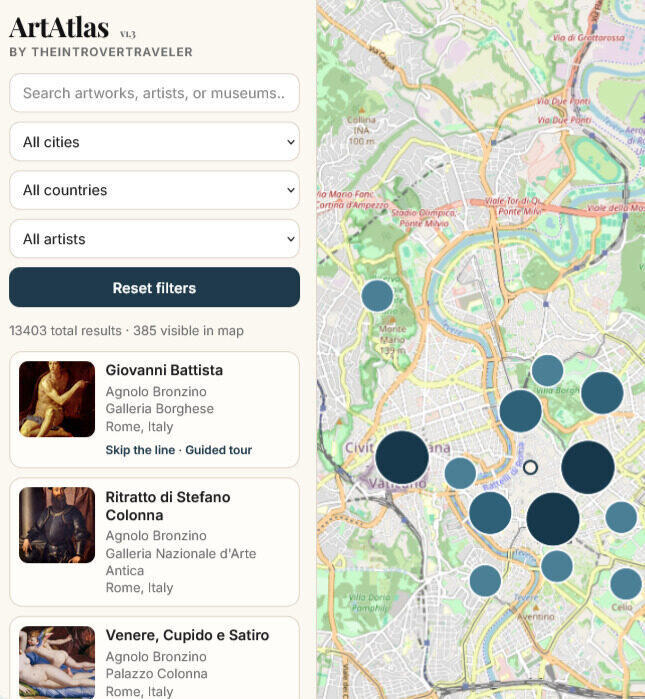
ArtAtlas is an interactive art map built for people who plan cultural trips around artworks, not around popularity. It geolocates tens of thousands of works across museums, churches and cultural sites worldwide, and organises them so that geography becomes a genuine tool for planning and discovery.
Why it exists
Most art content is narrative. Museum guides tell you what a work means. Travel articles tell you which museums to visit. Very little of it is operational — designed to help you make decisions in space, in real time, with a finite amount of time on your hands.
You can enter a church without knowing what matters inside. You can cross an entire city while missing its most relevant works. You can build a trip around generic top-ten lists instead of understanding the actual artistic density of a place.
ArtAtlas is built on a single premise: understanding art also requires knowing where it is. The dataset is selected with editorial judgment rather than accumulated blindly. Each city map is designed for usability and spatial logic — not mere completeness. The goal is clarity, not volume.
Three ways to use it
Before you leave
Design cultural itineraries using the spatial distribution of artworks as the organising principle — not travel rankings or scattered articles. Identify clusters, plan routes, understand what is worth a detour and what is not.
On the ground
Open the map while standing inside a city, a museum district or a church. Immediately see what is around you, what matters in the building you just walked into, and what you would miss if you left now.
At home, for study
Use ArtAtlas as a spatial reading tool. Understand how artists, collections and periods relate across territory. See where a school of painting clustered, how a patron's commissions spread across a city, or how one church compares to the next.
Map first. Then go deeper.
ArtAtlas is built in connection with TheIntroverTraveler, an editorial project dedicated to slow, culture-driven travel. The two are designed to work together: ArtAtlas identifies what matters in space; TheIntroverTraveler explains why it matters historically, artistically and culturally.
City maps are paired with destination guides, museum essays, and long-form analysis. You can start from Florence, Rome, Naples — or browse by artist and let geography do the rest.
Frequently asked questions
What exactly is ArtAtlas?
A web-based art map platform that geolocates artworks, museums, churches and cultural sites worldwide, designed for cultural travelers, students and researchers who want more spatial precision than a standard guide provides.
Is it free?
Yes. ArtAtlas is currently a free platform. Future premium features — curated itineraries, personalised routes — are in development.
Who curates the data?
The dataset is built and maintained editorially by the team behind TheIntroverTraveler. The priority is accuracy and relevance over sheer volume — every entry is selected with judgment rather than scraped automatically.
How does ArtAtlas differ from Google Maps?
Google Maps tells you where a museum is. ArtAtlas tells you which works are inside it, whether a nearby church contains something more interesting, and how to structure a morning around what actually matters rather than what is most searched.
Release notes
A running record of what has been added, fixed and improved.
Title normalisation & dataset expansion
- All artwork titles across the dataset have been normalised to English
- Added works by Henry Moore, Frida Kahlo, Gian Lorenzo Bernini and Peter Paul Rubens
- Added the complete catalogue of the Collezione Cerruti, Rivoli
Dataset expansion
- Added works by Giorgio de Chirico, Henri Matisse, Dosso Dossi and Salvador Dalí
- Added works from the Collezione Cerruti, Rivoli
Pop-up card improvements & dataset expansion
- Artist names in artwork pop-up cards are now clickable and link to the corresponding artist page
- Tapping the thumbnail in a pop-up card now opens the full-resolution image in an enlarged lightbox view, without leaving the map
- Added artworks and biographical data for Jacopo della Quercia, Donatello and Giorgione
Dataset expansion
- Added works by Guercino, Andy Warhol, Marc Chagall, Edvard Munch, Paul Klee and Jackson Pollock
URL parameters, deep linking & map improvements
- Fixed thumbnail rendering issues across multiple data sources, improving visual consistency in pop-ups and result cards
- Introduced dynamic URL parameters (city, country, artist, search), enabling deep linking and shareable filtered views
- Automatic zoom based on filtered results for more intuitive, context-aware navigation
- Enhanced synchronisation between UI state and URL, including browser back/forward navigation support
- Minor refinements to filter handling, mobile interaction and overall performance
Dataset expansion
- Added works by Paul Cézanne, Giovan Battista Tiepolo and Vasily Kandinsky
Tiqets integration & UX improvements
- Added direct purchase links via Tiqets for skip-the-line tickets and guided tours at the most visited museums
- Minor UX improvements and bug fixes
Initial public launch
- Retired the early Tableau-based prototype
- Launched a fully rebuilt modern version of ArtAtlas with an updated technology stack
Start with the map.
Open ArtAtlas to explore geolocated artworks, plan cultural trips with more precision, and move through cities the way art actually distributes itself across them.