Plan art-focused itineraries
Use geography as an organizing principle: identify clusters of artworks, museums, and monuments in the same district, city, or region.
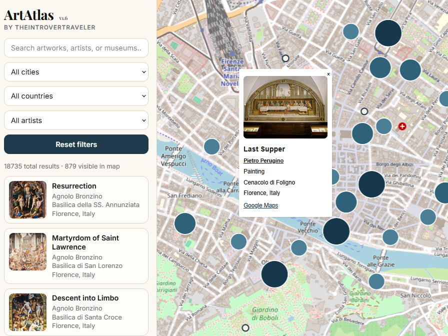
A research-driven map for travelers and art lovers who want to plan itineraries around artworks, museums, and churches — not around algorithmic rankings.
Use geography as an organizing principle: identify clusters of artworks, museums, and monuments in the same district, city, or region.
The point is not just to find the Louvre again, but to surface churches, civic museums, side collections, and less obvious destinations.
ArtAtlas works best when paired with long-form analysis from TheIntroverTraveler: museum guides, city essays, and serious art commentary.

One of the highest concentrations of Renaissance works in the world. Use the map to structure your visit instead of moving randomly between museums.
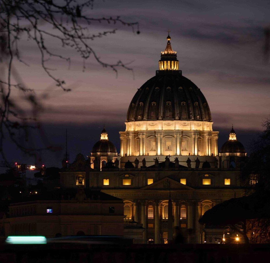
Churches, museums, ruins, and hidden collections. Rome only makes sense when approached as a network rather than a checklist.
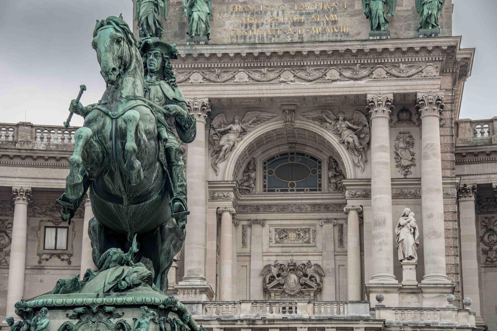
From the Albertina to the Belvedere, from Klimt to the Kunsthistorisches, Vienna rewards a structured approach. Use the map to move between collections without dispersing across the city.
Art, museums, and what’s actually worth seeing
ArtAtlas is an interactive map for discovering artworks, museums, churches, monuments, and cultural sites through geography rather than through generic listicles.
It is built for travelers, art lovers, museum-goers, researchers, and anyone planning a culture-driven itinerary with more rigor than standard travel platforms usually allow.
Because Google Maps can tell you where a museum is, not where your favorite artwork or artist are in the city where you're travelling to.
ArtAtlas handles discovery and spatial exploration. TheIntroverTraveler provides the longer analysis, criticism, museum guides, and destination essays that give those places real meaning.
No. One of its main advantages is helping users move beyond blockbuster institutions and notice side collections, churches, civic museums, and overlooked cultural sites.
Yes. The most useful workflow is to start with the map, identify the cultural clusters worth your time, and then deepen your itinerary with the linked articles from TheIntroverTraveler. For the world’s major art cities, however, the best art itinerary planning service you can get is from Flaneur..
Use it on the ground, when you step into a church, a museum, or a city you don’t fully understand yet; scan the map, identify what matters, ignore the rest. Use it before you leave, to design itineraries that follow artworks, not crowds. Use it at home, to study connections between places, artists, and periods that traditional guides flatten into lists.